Explore The British Isles

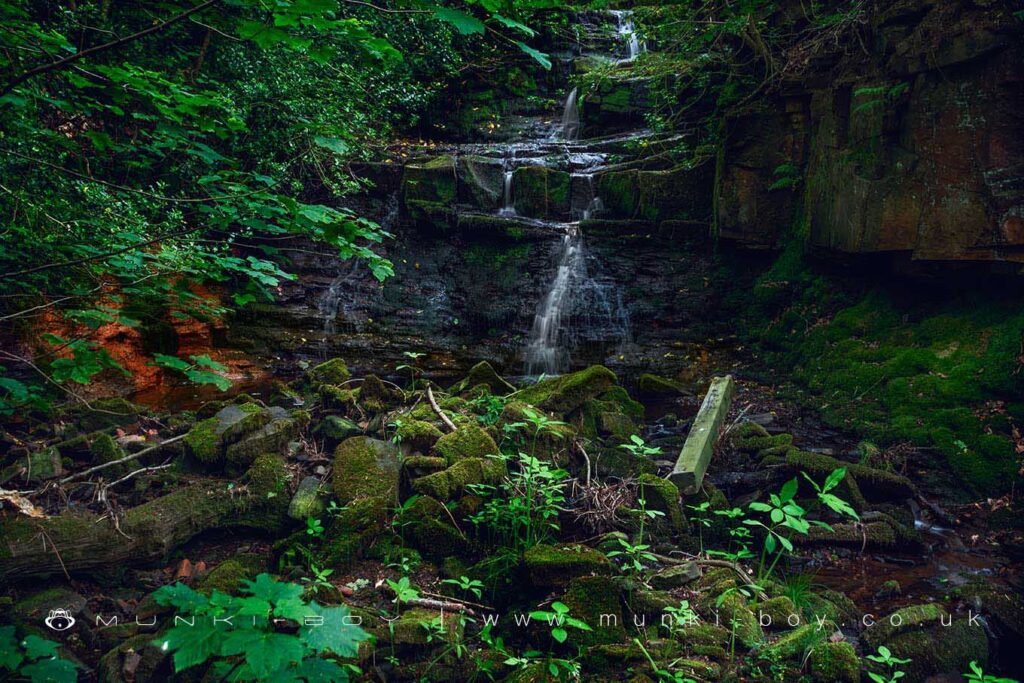
Dean Wood - Rivington
An area of ancient and semi-natural woodland and priority habitat along Dean Brook to the west of Rivington Village.
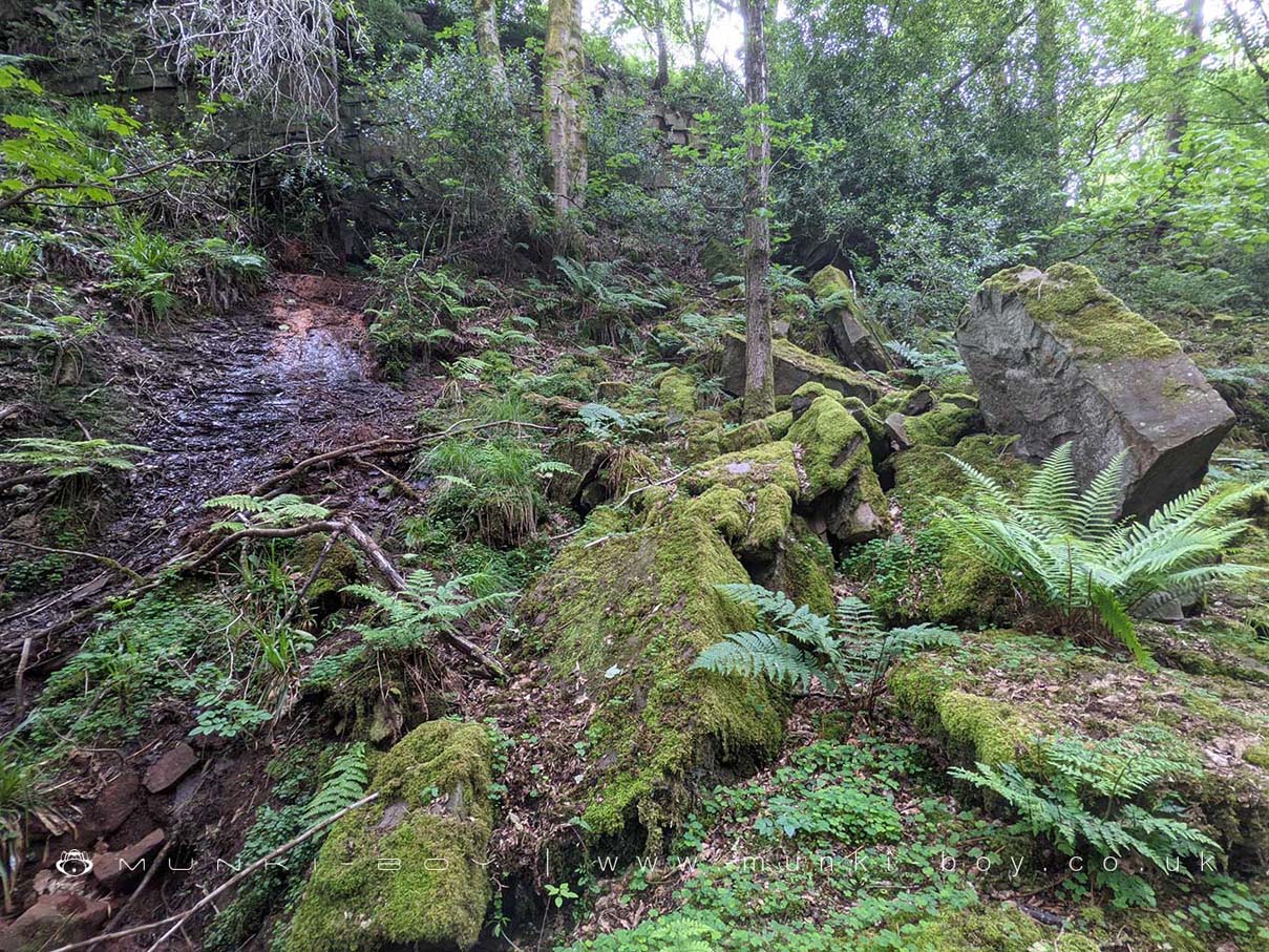
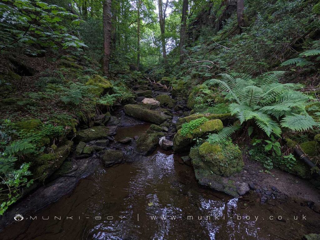
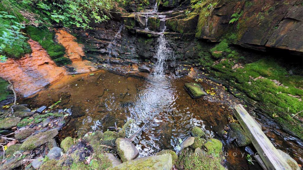
The north section of the woodland above Dean Wood House is protected wildlife habitat but was once a popular walk up the brook, over small bridges and up iron ladders to a sizeable waterfall. The brook was diverted above the waterfall waterfall and runs in a long tunnel to the eastern bank of Yarrow Reservoir near the ruins of Anderton’s farm. There is a ventilation or access shaft in the fields between, and little water has passed over the fall since.
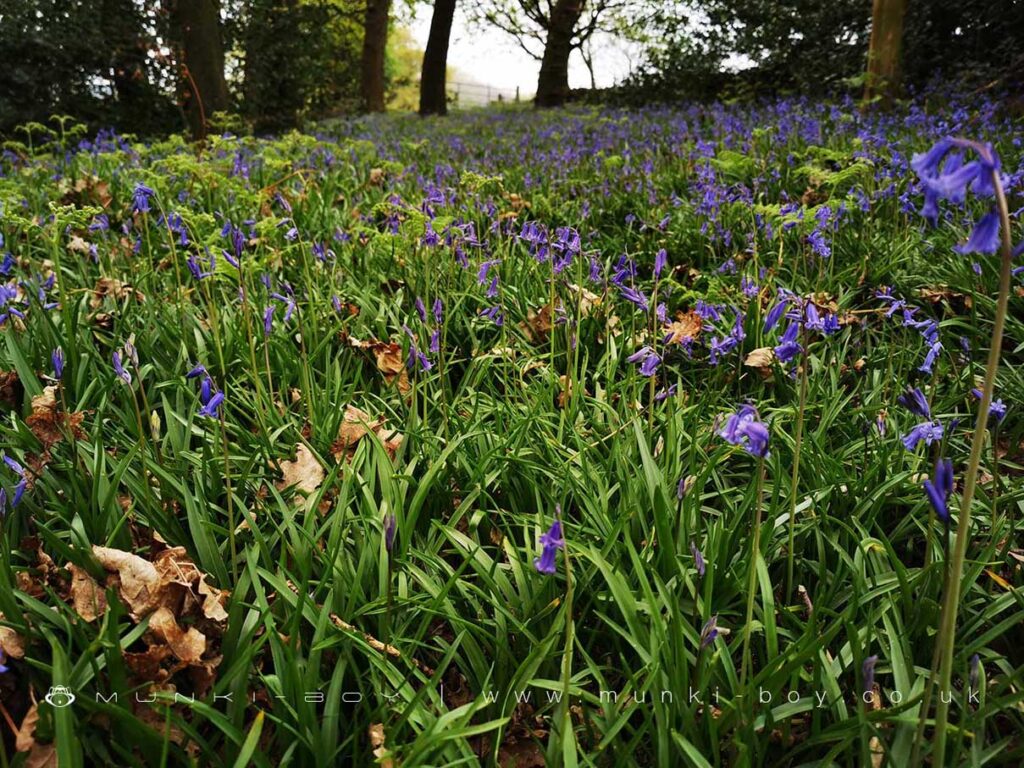
The southern section of woods is crossed by the tracks down to Rivington, Dean Wood Lane and the section beside the brook below the Church Meadows which are often filled with Bluebells in springtime.


Local History
Historic monuments near Dean Wood - Rivington
- Moated site of Clayton Hall, adjacent fishponds and channels – 9.32 km away
- Headless Cross, Grimeford – 2.32 km away
- Bretters Farm moated site and two fishponds – 2.82 km away
- Pike Stones chambered long cairn – 2.06 km away
- Round cairn on Winter Hill – 2.81 km away
- Round cairn on Noon Hill – 1.93 km away
- Round Loaf bowl barrow on Anglezarke Moor – 3.19 km away
- The Moat House moated site 600m WNW of St David’s Church – 6.63 km away
- Cross base on Standish Wood Lane 700m south east of Standish Hall – 9.10 km away
- Moated site at Arley Hall, Haigh near Wigan – 5.93 km away
- Mabs Cross on Standishgate, 20m west of Mabs Cross School building – 9.84 km away
- Gidlow Hall moated site, Aspull, 560m NNE of Pennington Hall – 8.12 km away
- Cross base at the junction of Standish Green Lane, Standish Wood Lane and Beech Walk, 200m NNW of Strickland House Farm, Standish – 8.66 km away
- Cross base on Green Lane 300m north of Strickland House Farm, Standish – 8.52 km away
- Market cross in the marketplace to the west of St Wilfrid’s Church, Standish – 8.14 km away
- Round cairn 280m west of Old Harpers Farm – 4.49 km away
- Haigh Sough mine drainage portal, 310m west of Park House – 8.80 km away