Explore The British Isles

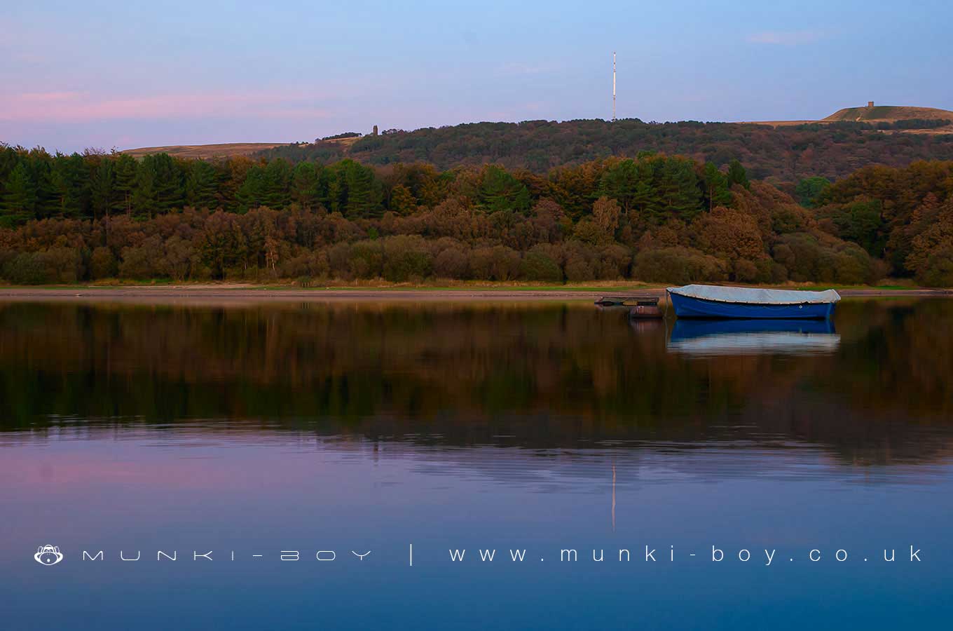
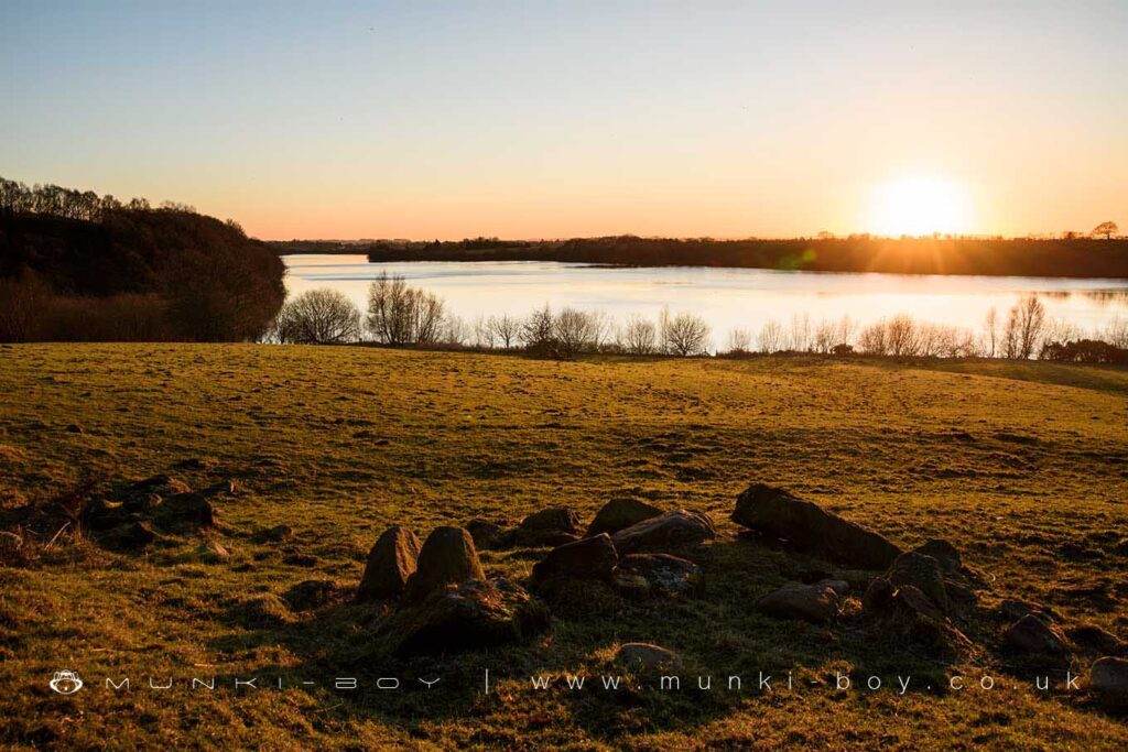
Rivington Lakes And Reservoirs
Constructed between 1850 and 1857 and designed by Thomas Hawksley the well known ‘three lakes’ of Anglezarke reservoir, Upper and Lower Rivington reservoirs together with Yarrow Reservoir were once the cutting edge of reservoir technology. Hawksley’s addition of filter beds to aid with water treatment was somewhat revolutionary and lasted for around 100 years until their replacement in latter half of the 20th Century.
This impressive chain of reservoirs spans the length of several small valleys that were dammed and flooded using seven structural embankments. The often overlooked High Bullough reservoir pre-dates the others and is notably smaller. High Bullough was originally constructed to supply water to Chorley.
Several hamlets and an inn were all abandoned and drown beneath the waters after construction of the reservoirs was completed, together with a large section of the River Yarrow and apparently some beautiful walking country of which local people were especially fond.
The local reservoir system is linked to Roddlesworth and to other reservoirs miles away in the Prescott area and are owned and maintened by the Liverpool water authority.


Local History
Historic monuments near Rivington Lakes And Reservoirs
- Moated site of Clayton Hall, adjacent fishponds and channels – 9.51 km away
- Headless Cross, Grimeford – 1.45 km away
- Bretters Farm moated site and two fishponds – 2.44 km away
- Pike Stones chambered long cairn – 2.83 km away
- Round cairn on Winter Hill – 3.43 km away
- Round cairn on Noon Hill – 2.56 km away
- Round Loaf bowl barrow on Anglezarke Moor – 4.08 km away
- The Moat House moated site 600m WNW of St David’s Church – 5.73 km away
- Cross base on Standish Wood Lane 700m south east of Standish Hall – 8.18 km away
- Moated site at Arley Hall, Haigh near Wigan – 5.00 km away
- Mabs Cross on Standishgate, 20m west of Mabs Cross School building – 8.94 km away
- Gidlow Hall moated site, Aspull, 560m NNE of Pennington Hall – 7.40 km away
- Cross base at the junction of Standish Green Lane, Standish Wood Lane and Beech Walk, 200m NNW of Strickland House Farm, Standish – 7.75 km away
- Cross base on Green Lane 300m north of Strickland House Farm, Standish – 7.61 km away
- Market cross in the marketplace to the west of St Wilfrid’s Church, Standish – 7.24 km away
- Round cairn 280m west of Old Harpers Farm – 4.59 km away
- Haigh Sough mine drainage portal, 310m west of Park House – 7.90 km away