Explore The British Isles

Owshaw Clough Mine Filtration Ruins
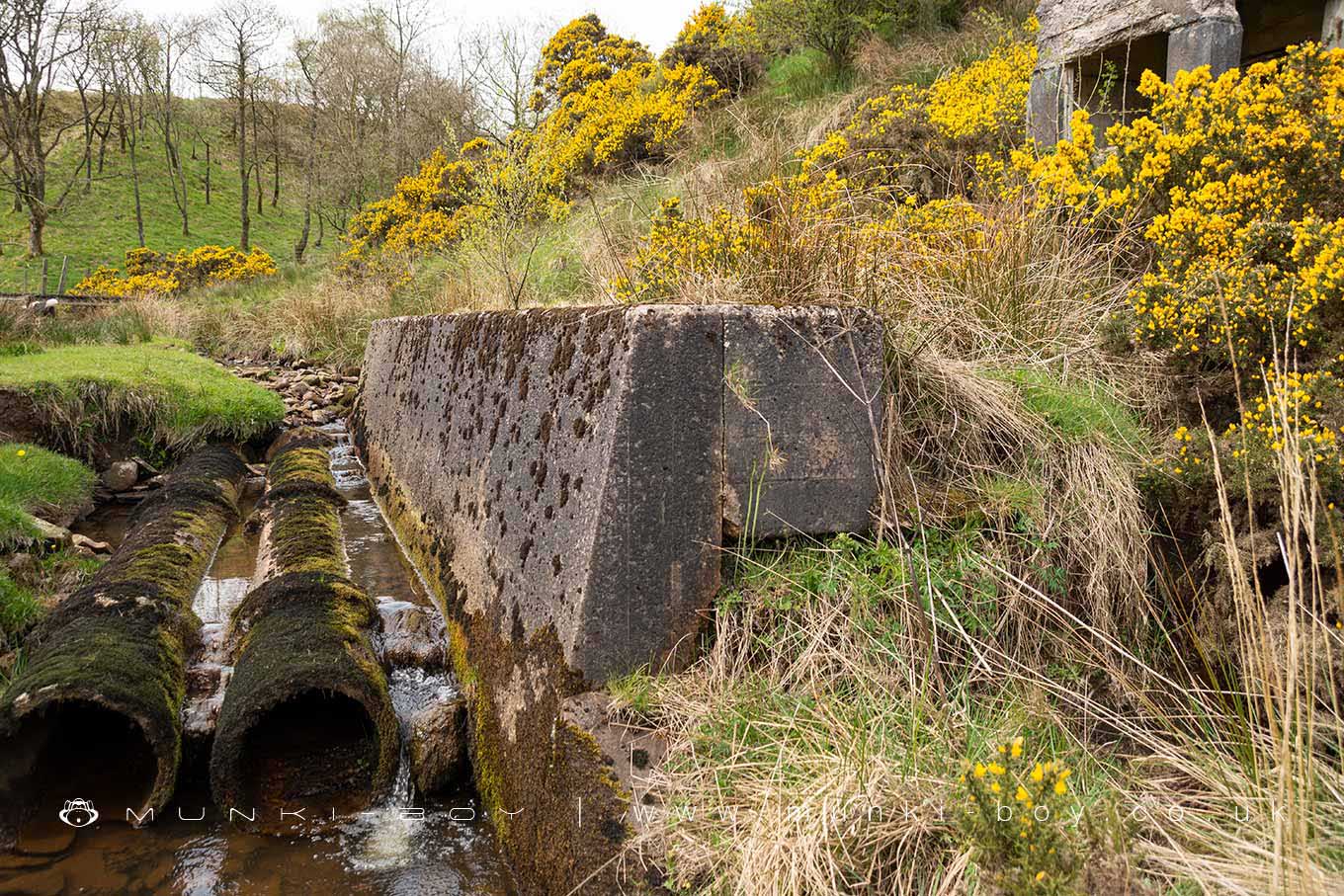
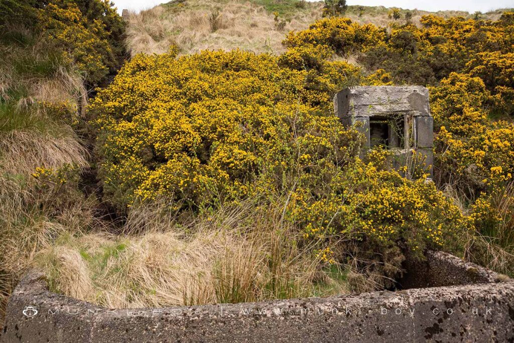
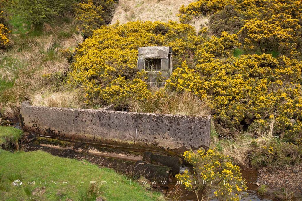
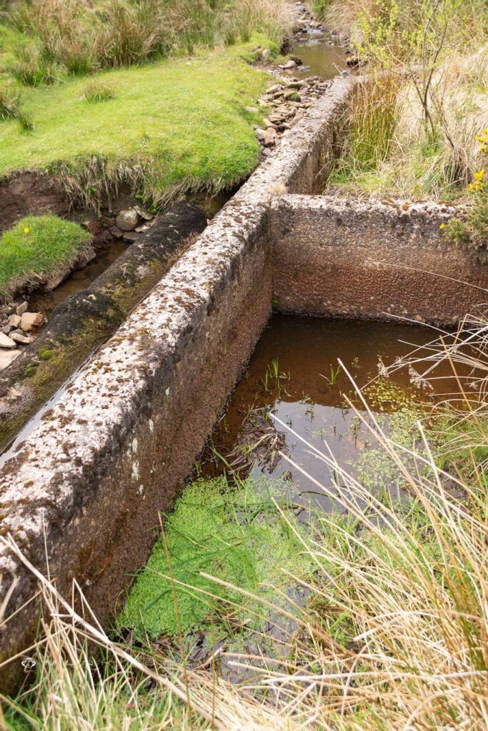
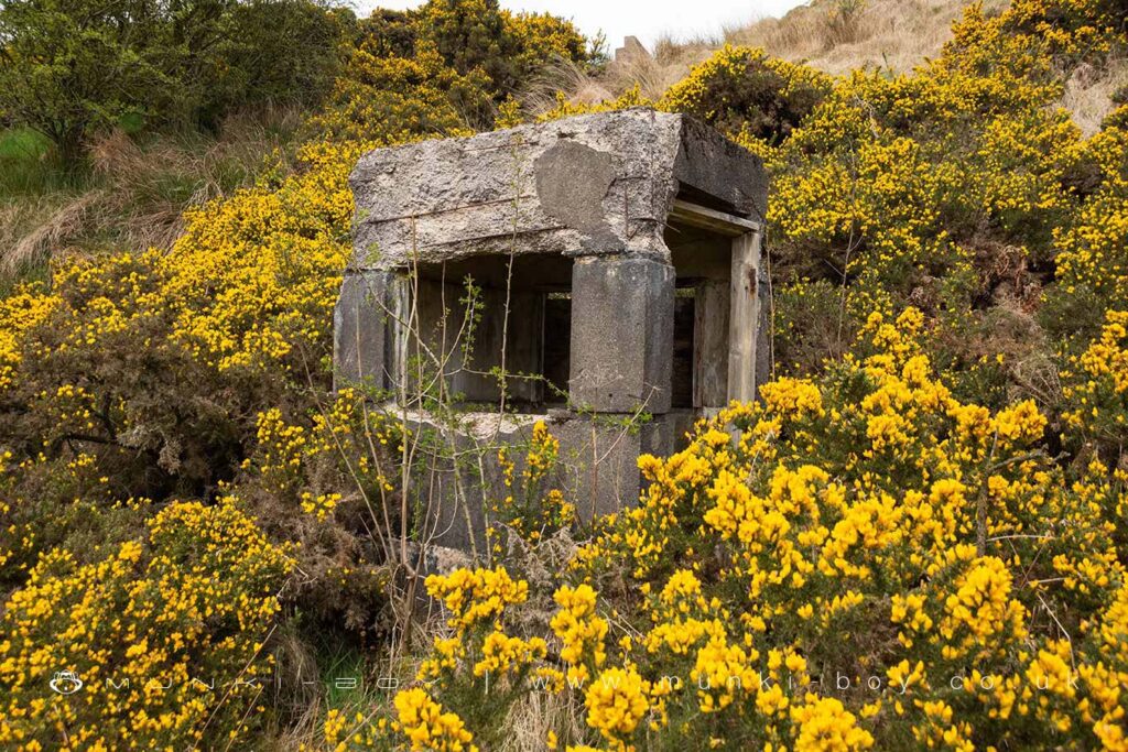
The ruined filter beds and small ‘hut’ are made from concrete and are of an uncertain age. Certainly more recently constructed than the old mines but of a style of construction perhaps used in the 1950s or a bit earlier. The buildings aren’t shown on any maps that I know of.
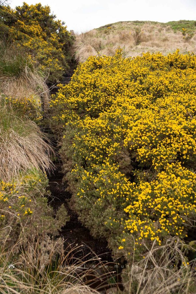
A narrow aeration cascade leads down the hillside to some small filter beds before a weird little concrete hut with windows. There are old pipes in the stream bed of the Stones Bank Brook just below that perhaps kept the water separated.
There is an old mine shaft on the flat land above around 10 metres vertically. Imagining the water to flow out of the mine at the lowest level, perhaps the old shaft was around this deep.
Water flowing out from mines is generally heavily contaminated with various metals and other minerals – naturally occuring but liberated from the rock in large quantities – that can poison waterways it flows into. In this area the mines where for coal and fireclay but they release a lot of iron from associated rock strata which can be seen as reddish ‘ochre’ where it reaches the surface.
Local History
Historic monuments near Owshaw Clough Mine Filtration Ruins
- Coking ovens and associated coal workings on Aushaw Moss 450m south west of Lower House – 4.78 km away
- Stone circle, ring cairn and two round cairns on Cheetham Close – 2.53 km away
- Round Loaf bowl barrow on Anglezarke Moor – 5.68 km away
- Round cairn on Noon Hill – 5.15 km away
- Round cairn on Winter Hill – 4.35 km away
- Roman road at Bottom o’ th’ Knotts Brow – 5.32 km away
- Steam tramway reversing triangle – 3.45 km away
- Affetside Cross at Affetside 75m north west of the Pack Horse Inn – 6.96 km away
- Round cairn 280m west of Old Harpers Farm – 5.65 km away