Explore The British Isles

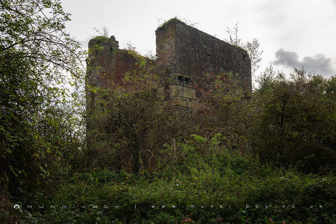
Albion Iron Works Aspull (ruin)
The Albion Iron Works once stood on the banks of the Leeds and Liverpool Canal at Aspull Top Lock.
Iron was worked here from the turn of the 20th Century and the works were served by a branch of the local Mineral Railway down to the canal and to local coal pits and the large coke works nearby.
Not much remains visible today as the site is a polluted-looking swamp in the North section and terribly overgrown around the only upstanding walls – an old engine house – the more interesting side of which is best glimpsed from the canal area.
This area is fenced off and doesn’t seem to be part of the Kirkless Wood public area although a footpath goes round the perimeter.
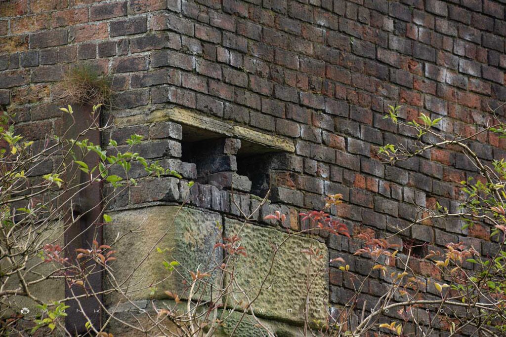
Old Engine Ports at Albion Iron Works Aspull
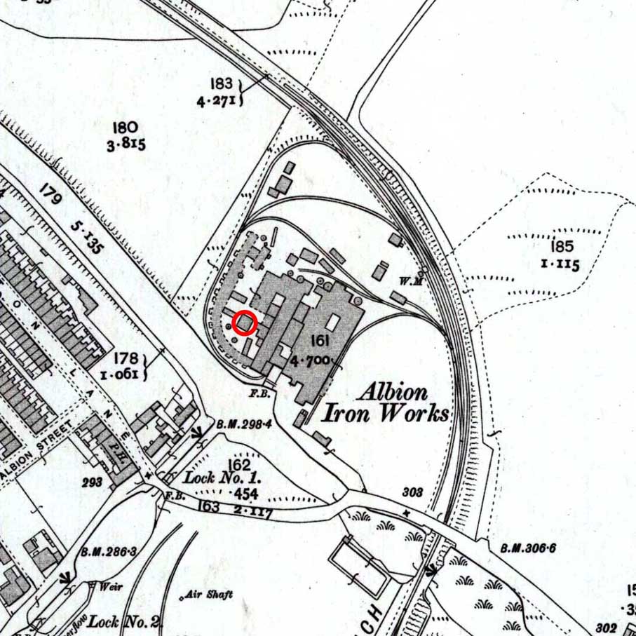
Old Map of Albion Iron Works, Aspull (engine house circled)
Local History
Historic monuments near Albion Iron Works Aspull (ruin)
- Bretters Farm moated site and two fishponds – 8.62 km away
- Headless Cross, Grimeford – 6.23 km away
- Round cairn on Noon Hill – 8.97 km away
- Round cairn on Winter Hill – 9.40 km away
- The Moat House moated site 600m WNW of St David’s Church – 2.38 km away
- Market cross in the marketplace to the west of St Wilfrid’s Church, Standish – 5.70 km away
- Cross base on Green Lane 300m north of Strickland House Farm, Standish – 5.34 km away
- Cross base at the junction of Standish Green Lane, Standish Wood Lane and Beech Walk, 200m NNW of Strickland House Farm, Standish – 5.38 km away
- Gidlow Hall moated site, Aspull, 560m NNE of Pennington Hall – 1.67 km away
- Mabs Cross on Standishgate, 20m west of Mabs Cross School building – 2.40 km away
- Moated site at Arley Hall, Haigh near Wigan – 4.29 km away
- Cross base on Standish Wood Lane 700m south east of Standish Hall – 4.96 km away
- Winstanley moated site and five fishponds – 7.39 km away
- Round cairn 280m west of Old Harpers Farm – 7.74 km away
- Haigh Sough mine drainage portal, 310m west of Park House – 1.77 km away