Explore The British Isles

Nob End SSSI
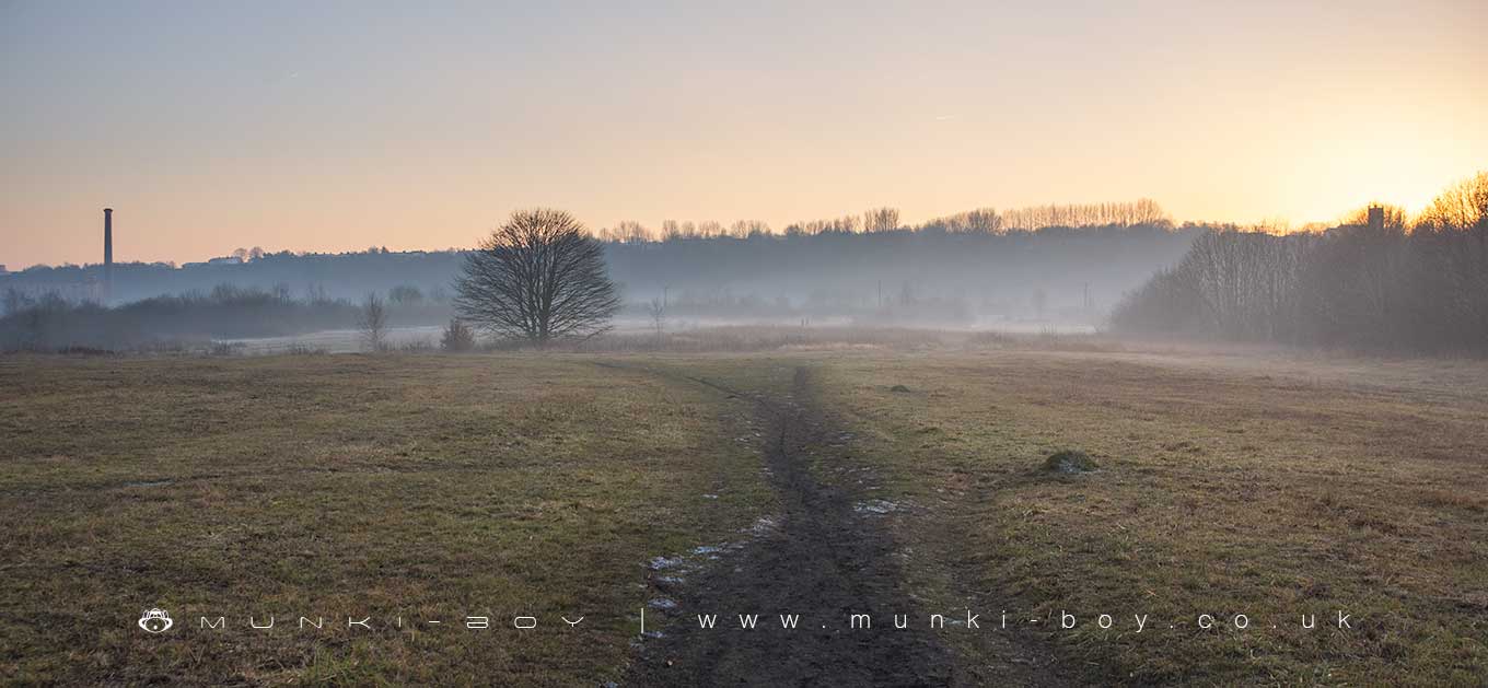
The Nob End SSSI occupies an area of post-industrial wasteland in the triangle of land that is the confluence the rivers of Croal and Irwell in Bolton and is a serious spot for flora despite its humorous name.
Nob End SSSI has a formidable range of interesting and rare plants, insects, birds, mammals and wildlife with perhaps the main attraction being the orchids when in season, although deer are not uncommon. The riverside banks of the Croal and Irwell aren’t easy to visit around this area and there is poisonous Giant Hogweed around too, but there is a stretch of canal to walk nearby and footpaths along either side of the Croal to the northwest of the area.
With regard to the names round here, the area to the northeast would have been the hamlet of Nob, with its titter inducing Nob Inn, and of course the peninsular Nob End. Don’t laugh too hard, you might scare the wildlife – it’s obvious that back when the places where named they didn’t have the same slang terms as us.
The site at Nob End is also a designated Local Nature Reserve, the Nob End LNR which covers an overlapping area with the SSSI, The western edge of the Nob End area is also part of the Moses Gate Country Park. A decent little walk follows down from the park along the Croal and returning along the other bank through the Nob End SSSI which is popular with dog walkers.
The industrial history of the Nob End SSSI Area
The land now designated for the Nob End SSSI has been heavily used during the industrial revolution and the ground is heavily modified such that it’s only possible to guess at the former land surface or its usage.
From historic records we find the area occupied by a coal mine with up to three shafts operating through the early 19th Century on the top end of the site, while the southern tip at the confluence of the Croal and Irwell occupied by the old Prestolee Cotton Mill that would have taken advantage of the nearby water sources. There were also several large mill ponds beside the old mill around the area of the modern bridge and southwards together with several canals moving water from the main canal down to the ponds with a by-wash or overflow leading to the northwest corner of the site where it was taken underground to a stone arched tunnel at the river bed at the foot of the old Darley Bridge, all that remains of which today being a broken stone weir. The mouth of the old tunnel is still visible today, although it is blocked within a couple of metres.
One of the old mine shafts can be easily located today as it is surrounded by a square wooden fence and is found in the middle of the area where a rough patch of vegetation occurs.
According to the SSSI designation a large portion of the area has been buried under “alkali waste produced as a by-product of the Leblanc process for the making of sodium carbonate”, which is to say a soap making process for washing cloth. The old Prestolee Mill site must be buried under this layer together with a large amount of rubble and cinder, this is said to be as deep as 10 metres in places. This process seems to have been carried out by the Prestolee Works that occupied a large area at the East of the site, which in-turn was derelict apart from a couple of remaining buildings by the turn of the 20th Century.
No buildings remain on the site today but the shapes of some of the old canal sections can be seen in the ground and the outlines of several of the old Prestolee Works buidlings.

Local History
Historic monuments near Nob End SSSI
- Roman road at Bottom o’ th’ Knotts Brow – 9.16 km away
- Lime kiln and associated culvert 50m north of Worsley Methodist Church – 6.14 km away
- Bridgewater Canal’s Barton Aqueduct embankment and retaining walls – 8.74 km away
- Affetside Cross at Affetside 75m north west of the Pack Horse Inn – 7.38 km away
- Promontory fort called Castlesteads on the east bank of the Irwell 550m SSE of Banks Farm – 8.09 km away
- Radcliffe Tower and site of hall 100m south west of the parish church in Radcliffe – 4.70 km away
- Wardley Hall moated site, Worsley – 4.31 km away
- New Hall Moat, Astley, 200m north of Astley Hospital – 7.26 km away
- Medieval moated site and later fortified manor house known as Bury Castle 100m west of the parish church – 7.03 km away
- Canal tunnel entrances and wharf – 5.75 km away
- Ringley Old Bridge – 1.67 km away
- Morley’s Hall moated site – 9.26 km away
- Astley Green Colliery: engine house and headgear – 7.80 km away