Explore The British Isles

Duxbury Corn Mill (ruin)
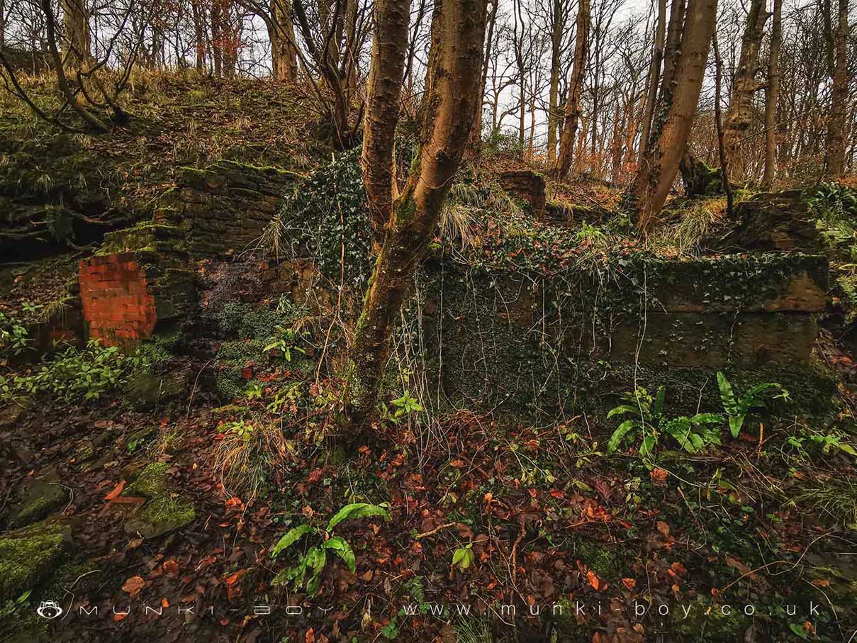
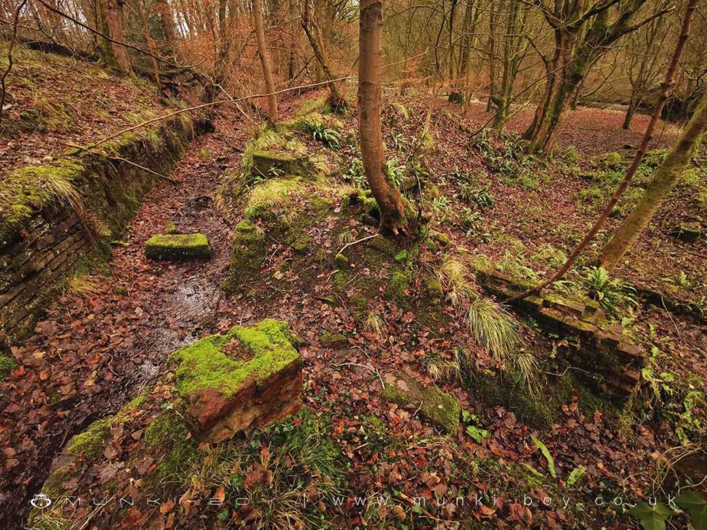
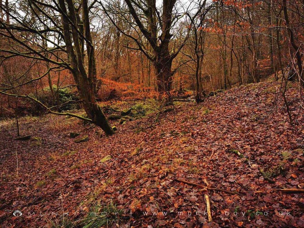
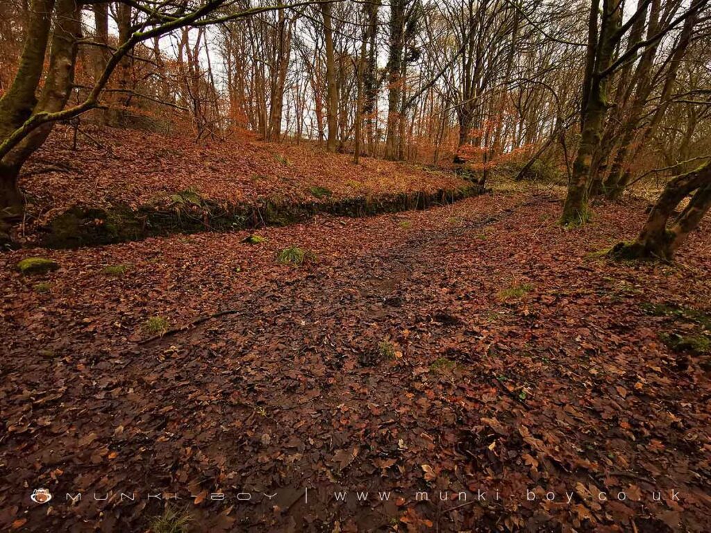
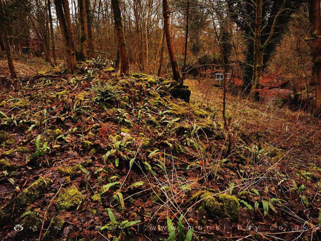
Shown in an old photograph as a four-storey brick building on a stone base before its decline at the end of the 19th Century, the ruins of Duxbury Corn Mill beside the River Yarrow are possibly on the site of a mill mentioned as early as 1354. The mill in its 18th Century incarnation undoubtedly relies entirely on the mill race or leat which runs along beside the Yarrow from a weir beyond the modern road upstream. The mill race, which was the subject of an archaeological excavation by Oxford Archaeology North in 2006 provided only evidence of activity dating back to the 17th Century. However, the mill race is perhaps unnecessarily long which might suggest it was made to reach a place already in existence rather than building a later mill closer to the water source. The oldest find was a fragment of a 2nd or 3rd Century Roman vessel – in sediment from a later time.
According to Oxford Archaeology North the mill is shown as “disused” on the 1895 OS map, however I can only find this on the 1908 after checking several sources, also they give a date of around 1920 for the demolition of the main mill building to which 1908 is closer. The split of building material of stone and brick probably indicates an earlier stone structure with later brick additions, on the mill site there is a wealth of stone and seemingly a lack of “four storeys” of brick which suggests the building was taken down for the brick to be re-used.
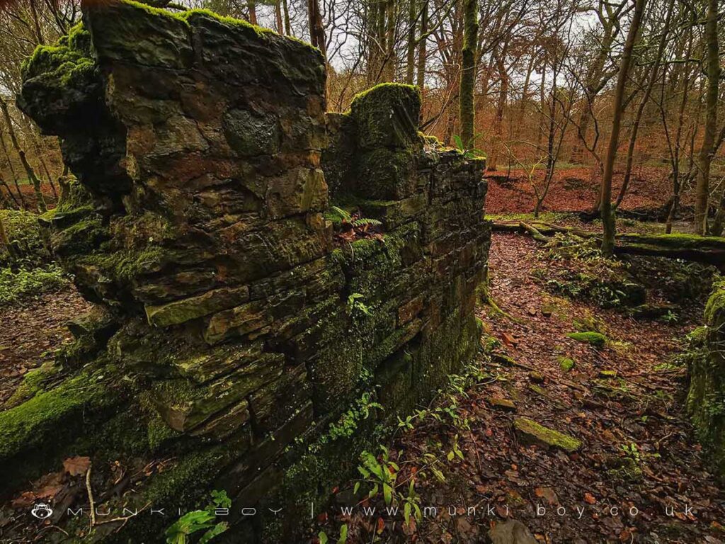
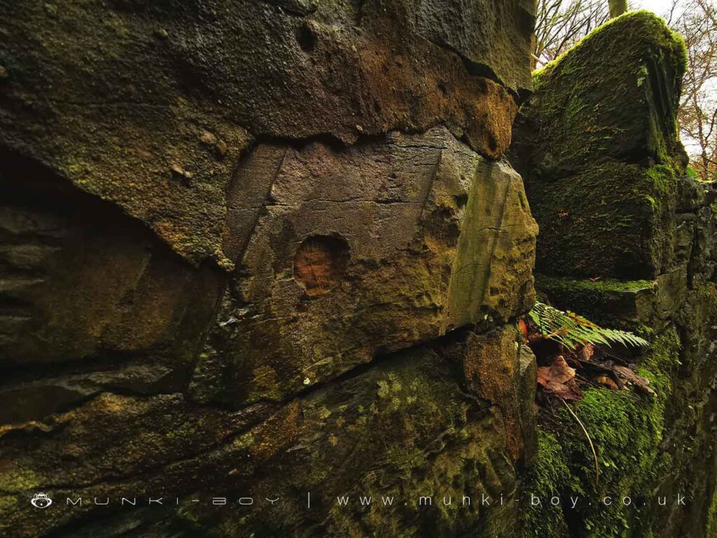
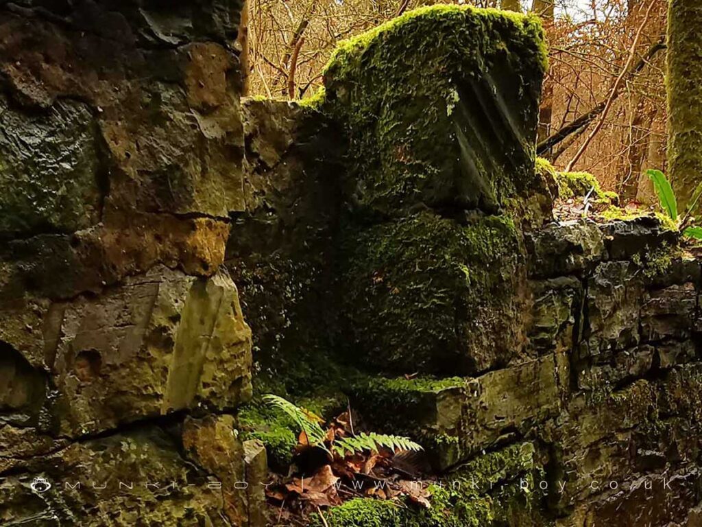
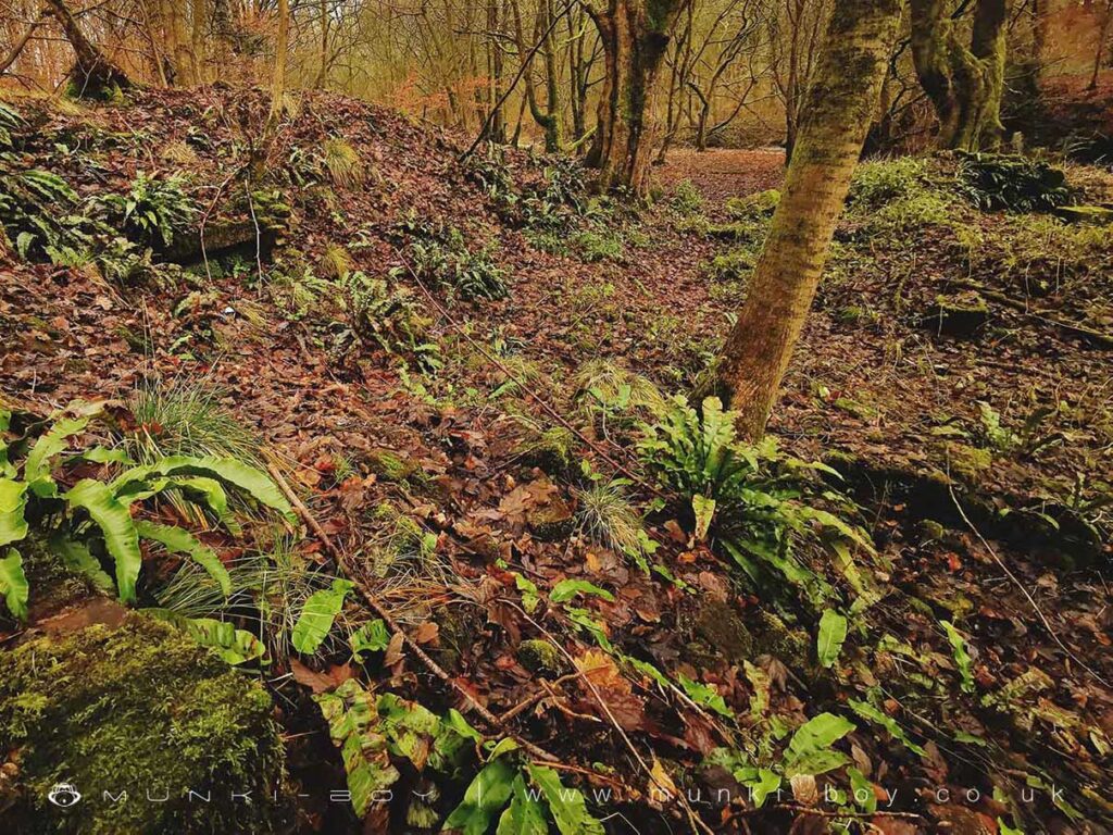
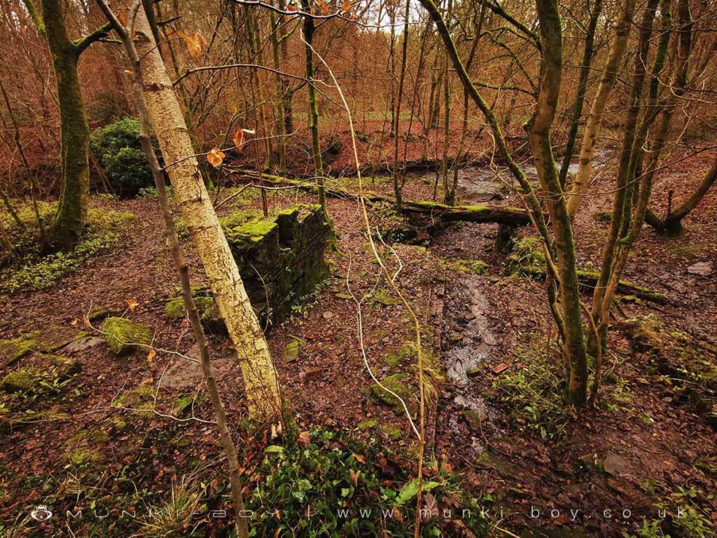
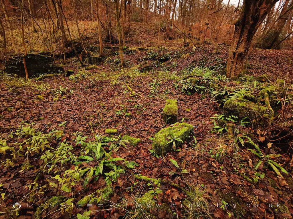
There is a section of stone wall standing today below the mill race, with a niche for the waterwheel axel to sit. I first noticed radial groove marks in the stone as though the old wheel had worn into the stone, yet I noted somehow not quite right. On closer examination the topmost stone on the right of the niche also displays radial grooves but in completely the wrong direction. The stone here is re-used from an earlier structure of an earlier waterwheel assembly (see photographs). It is unknowable but it could be evidence of the old 14th Century mill, or at least a very early phase of the mill documented in 1727.
Interestingly, William Pilkington in 1742 was required to keep the “Fleam Ditch” (mill race) clear as part of his lease. The archaeological excavation in 2006 found that the mill race was allowed to fill with silt by the end of the 19th Century. In 1867 the mill was described in a lease as being water-powered and equipped with nine stones together with attached house and garden.
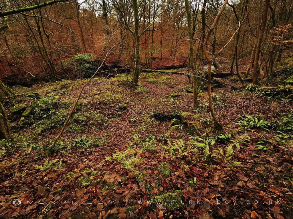
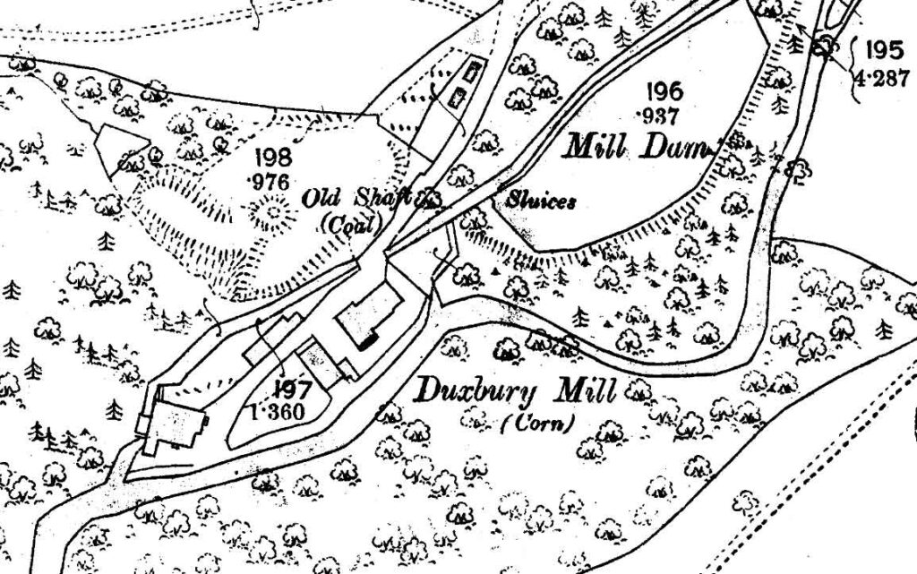
On the later maps the buildings adjacent to the demolished mill are shown as “Duxbury Mill Farm” together with around the end of the 19th Century a coal pit on the slope just above. There is also an NCB capped shaft just on above the bank of the Yarrow and below the farm buildings which are said by Ashmore (1969, 257) to be mined by Duxbury Colliery. Interestingly Duxbury Mill Farm is still shown on the 1970s maps although it is completely gone today.
Local History
Historic monuments near Duxbury Corn Mill (ruin)
- Moated site of Clayton Hall, adjacent fishponds and channels – 6.82 km away
- Headless Cross, Grimeford – 4.10 km away
- Bretters Farm moated site and two fishponds – 1.25 km away
- Pike Stones chambered long cairn – 4.29 km away
- Round cairn on Noon Hill – 5.99 km away
- Round Loaf bowl barrow on Anglezarke Moor – 5.67 km away
- Bradley Hall, moated site, fishponds and connecting channels – 5.87 km away
- The Moat House moated site 600m WNW of St David’s Church – 6.65 km away
- Cross base on Standish Wood Lane 700m south east of Standish Hall – 7.27 km away
- Moated site at Arley Hall, Haigh near Wigan – 4.96 km away
- Mabs Cross on Standishgate, 20m west of Mabs Cross School building – 9.35 km away
- Gidlow Hall moated site, Aspull, 560m NNE of Pennington Hall – 9.38 km away
- Cross base at the junction of Standish Green Lane, Standish Wood Lane and Beech Walk, 200m NNW of Strickland House Farm, Standish – 6.60 km away
- Cross base on Green Lane 300m north of Strickland House Farm, Standish – 6.48 km away
- Market cross in the marketplace to the west of St Wilfrid’s Church, Standish – 5.91 km away
- Haigh Sough mine drainage portal, 310m west of Park House – 8.47 km away