Explore The British Isles

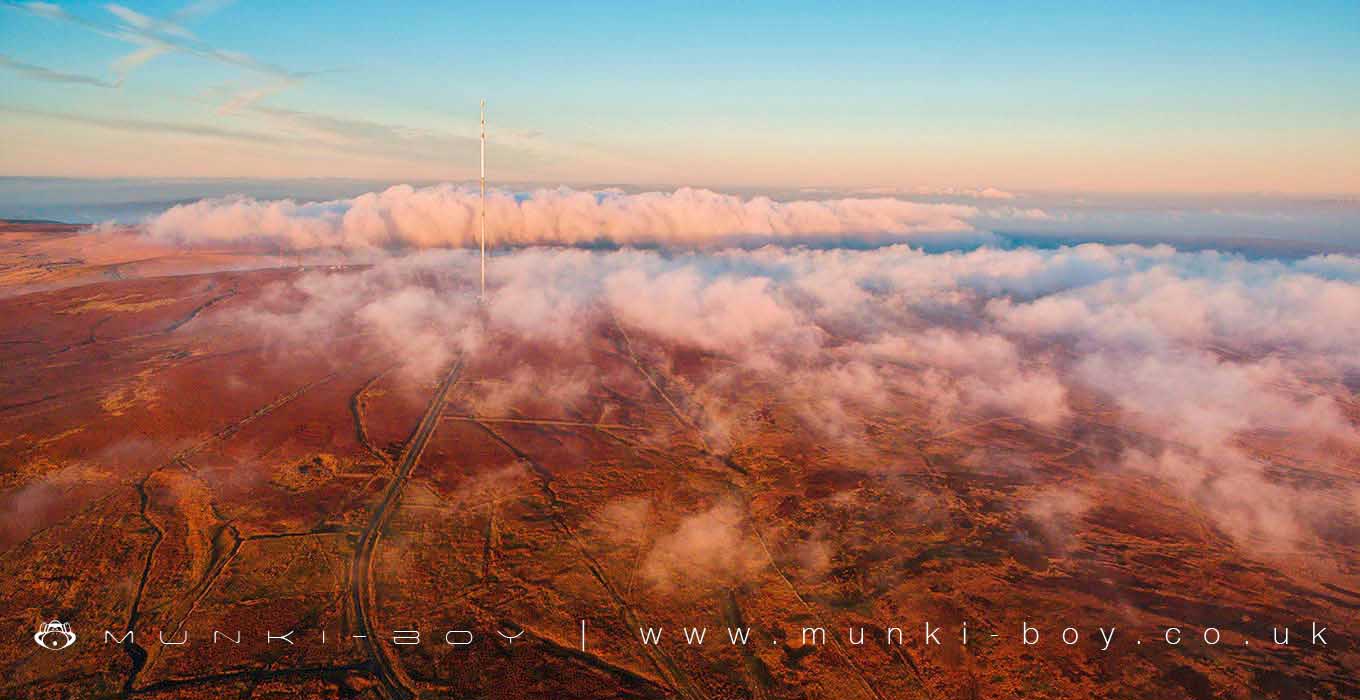
West Pennine Moors
The West Pennine Moors SSSI supports an extensive mosaic ofupland and upland-fringe habitats.It is of special interest for the following nationally important features that occur within and are supported by the wider habitat mosaic:
- blanket bogs
- wet and dry heathlands
- acid and lime-rich flushes
- rush pastures and mire grasslands
- acid grasslands
- neutral hay meadows and pastures
- wet and dry broadleaved woodlands and scrub
- diverse assemblages of upland moorland, in-bye and woodland breeding birds
- breeding black-headed gulls Chroicocephalus ridibundus, Mediterranean gulls Larus melanocephalus and grey herons Ardea cinerea
- populations of starry lady’s-mantle Alchemilla acutiloba, large-toothed lady’s-mantle A. subcrenata and floating water-plantain Luronium natans
The West Pennine Moors comprise three distinct areas of moorland bordered by major roads to the west and east, stretching from Horwich and Bolton in the south to Darwen in the north and to Haslingden and Ramsbottom in the east. Whilst geologically a continuation of the Millstone Grit series of the main Pennine range of uplands, it is physically separated from the South Pennines by the Irwell Valley. The area still retains the traditional Pennine character of open moorlands, from which streams descend into wooded cloughs, pastures and meadows, whilst being distinctive in character as a result of its western-oceanic influence and lower altitudes. Once the major source of income, agriculture is now fragmented by the built environment, industry and housing. This is a landscape of upland livestock farming and traditional field boundaries on large estates set against the strong urban character of many densely-populated nearby towns. The high rainfall and numerous streams running from the uplands made the area important as a supply of drinking water to the nearby conurbation of Greater Manchester. The many rivers and streams also led to the area’s prominence in the industrial revolution, with the valleys supporting many textile and other mill industries, as well as mining and quarrying. Industrialisation has left its mark on the West Pennine Moors, most noticeably the chain of reservoirs nestling between the moorland blocks, which now provide key habitat forbids, and the legacy of historic air pollution that has left many of the upland habitats lacking in species diversity.
Local History
Historic monuments near West Pennine Moors
- Coking ovens and associated coal workings on Aushaw Moss 450m south west of Lower House – 5.77 km away
- Pike Stones chambered long cairn – 6.60 km away
- Stone circle, ring cairn and two round cairns on Cheetham Close – 2.46 km away
- Round Loaf bowl barrow on Anglezarke Moor – 5.88 km away
- Round cairn on Noon Hill – 4.52 km away
- Round cairn on Winter Hill – 3.65 km away
- Roman road at Bottom o’ th’ Knotts Brow – 5.29 km away
- Steam tramway reversing triangle – 4.85 km away
- Affetside Cross at Affetside 75m north west of the Pack Horse Inn – 6.61 km away
- Round cairn 280m west of Old Harpers Farm – 4.40 km away